
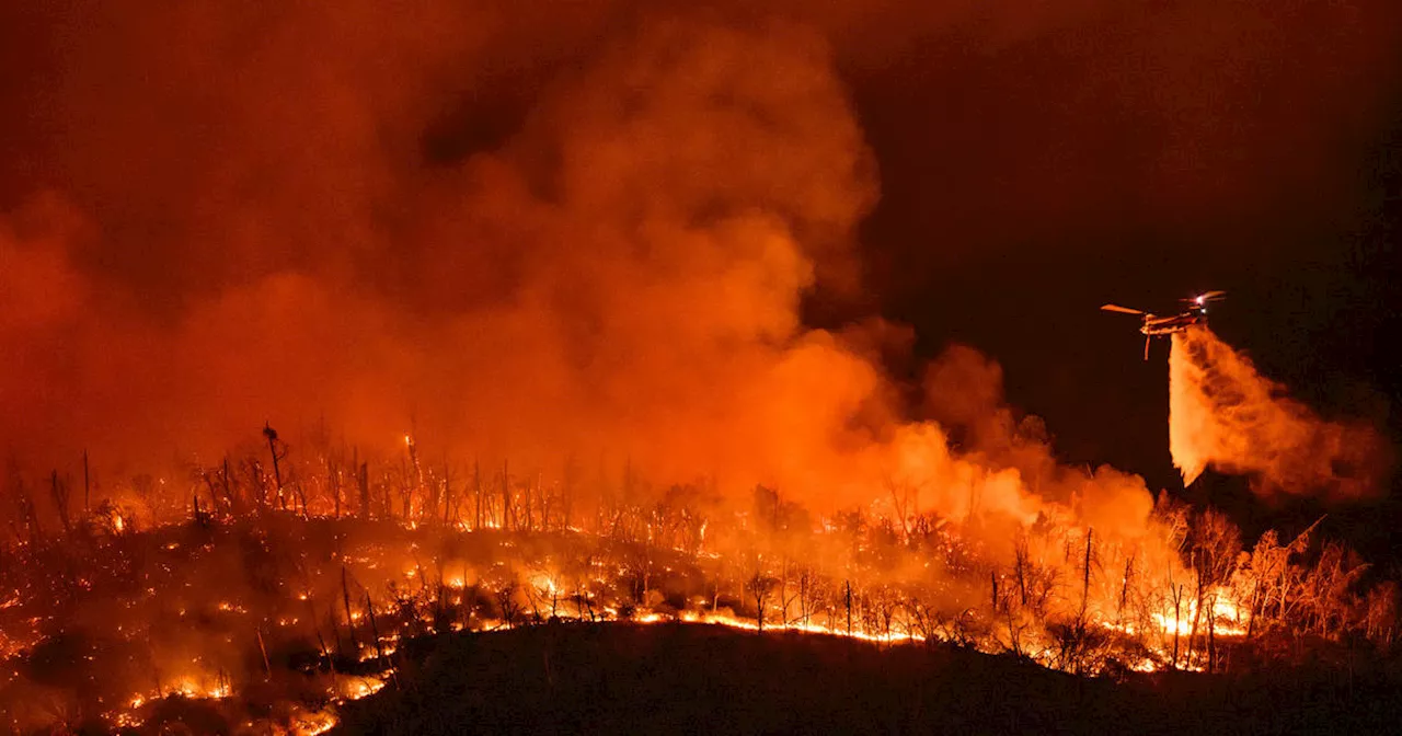
The blaze began on Tuesday morning and has since spread to more than 3,000 acres near Lake Oroville.
Thousands of California residents have been ordered to evacuate as the Thompson Fire continues to blaze near Cherokee Road and Thompson Flat Road in Oroville, California.The blaze ignited in Butte County on Tuesday morning, and has since grown to encompass more than 3,000 acres near Lake Oroville, California's second largest reservoir. As of the most recent update issued on early Wednesday morning, the fire was zero percent contained, although firefighting personnel were on scene.
Lake Oroville structures have also been evacuated, the California Department of Water Resources shared, including the Hyatt Powerplant facility and the Lake Oroville Visitor Center.'DWR is closely monitoring the Thompson Fire that started just north of Oroville Field Division facilities around noon Wednesday. Several State Water Project facilities are under evacuation orders issued by the Butte County Sheriff,' the DWR posted on X, formerly Twitter, on Tuesday night.
日本 最新ニュース, 日本 見出し
Similar News:他のニュース ソースから収集した、これに似たニュース記事を読むこともできます。
 Map: Thompson Fire and evacuation zones at Lake OrovilleAlmost 50 square miles on Lake Oroville’s west shore was under evacuation order for the Thompson Fire.
続きを読む »
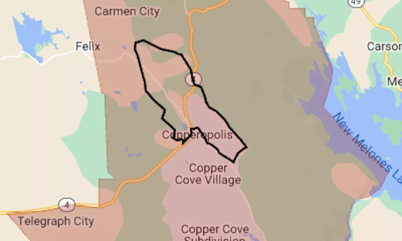 Aero Fire map: Evacuation ordered as wildfire nears CopperopolisThe map shows the evacuation area in red. The black line indicates the approximate perimeter of the fire.
続きを読む »
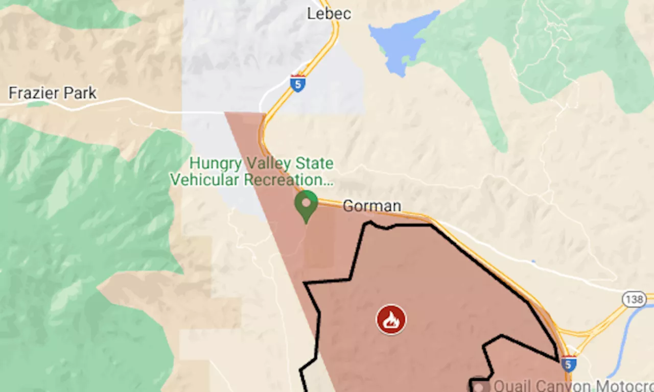 Post Fire map: Evacuation for biggest wildfire of California’s seasonWildfire in Los Angeles and Ventura counties has reached Pyramid Lake, along I-5’s Grapevine section.
続きを読む »
 Post Fire map: Evacuation near I-5’s Grapevine sectionThe Post Fire, which was reported Saturday afternoon, already California’s second-biggest wildfire of the season.
続きを読む »
 Thompson Fire in Butte County prompts slew of evacuation orders near OrovilleEvacuation orders and warnings went out in part of Butte County near Oroville due to the Thompson Fire on Tuesday.
続きを読む »
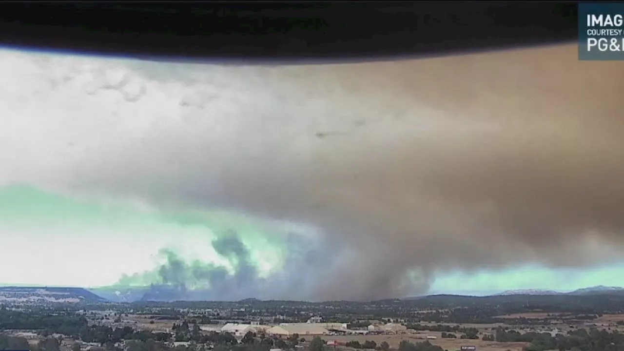 Thompson Fire near Oroville prompts mass evacuation warningsOfficials in Butte County say 13,000 people are being evacuated from a vegetation fire that is at 2,136 acres.
続きを読む »