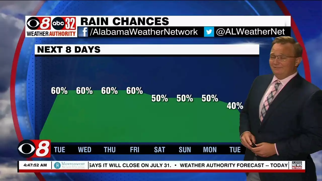
We have a weak boundary stalled across the state; it along with lots of moisture will allow for numerous showers and storms across the Alabama landscape each day this week.
Rain and storms are possible at anytime, but the greatest coverage will come during the afternoon and evening hours, between 1PM and 10PM. The chance of any one spot getting wet each day is 50-70 percent if you like the numbers game, but it won’t rain everywhere every day, but mostly places stand a good chance of seeing several downpours this week.
FOURTH OF JULY WEEKEND: The weather won’t change much over the long holiday weekend. You will see some sun at times Saturday, Sunday, and Monday, but from time to time a passing shower or storm is likely, especially during the afternoon and evening hours. Highs will be mostly in the low 90s. IN THE TROPICS: NHC is waiting on Bonnie: At 500 AM AST, the poorly defined disturbance was centered near latitude 9.3 North, longitude 55.2 West. The system is moving toward the west near 23 mph. A westward or west-northwestward motion is expected through Thursday. On the forecast track, the system will pass near or over portions of the southern Windward Islands by tonight, and move over the southern Caribbean Sea or near the northern coast of Venezuela on Wednesday and Thursday.