
Ian went from tropical storm to Category 4 monster in 36 hours. It's a dangerous phenomenon that climate change may make more common.
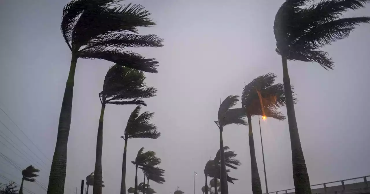
MIAMI — Before Hurricane Ian slammed into Florida's southwest coast with 155 mph winds, it went through two separate bursts of so-called"rapid intensification" when a cyclone's top wind speeds rise by 35 mph in a single day.
There are three main factors that lead to rapid intensification: warm waters, stable atmospheric conditions, and high humidity in the middle layers of the atmosphere. All three will be exacerbated by climate change. Oceans have absorbed about 90% of the heat from man-made climate change. A third of that heat has gone into surface waters, which have warmed, on average, 0.14 degrees Fahrenheit per decade since 1901, according to the National Oceanic and Atmospheric Administration .
Vertical wind shear often acts as a stumbling block that prevents storms from intensifying. But researchers at Columbia University and NOAA predict that climate change will weaken vertical wind shear along the U.S. east coast, removing an obstacle for growing hurricanes. In less than 36 hours between Sunday night and Tuesday morning, National Hurricane Center bulletins show that Ian strengthened from a tropical storm with 60 mph winds into a Category 3 hurricane with 125 mph winds.
日本 最新ニュース, 日本 見出し
Similar News:他のニュース ソースから収集した、これに似たニュース記事を読むこともできます。
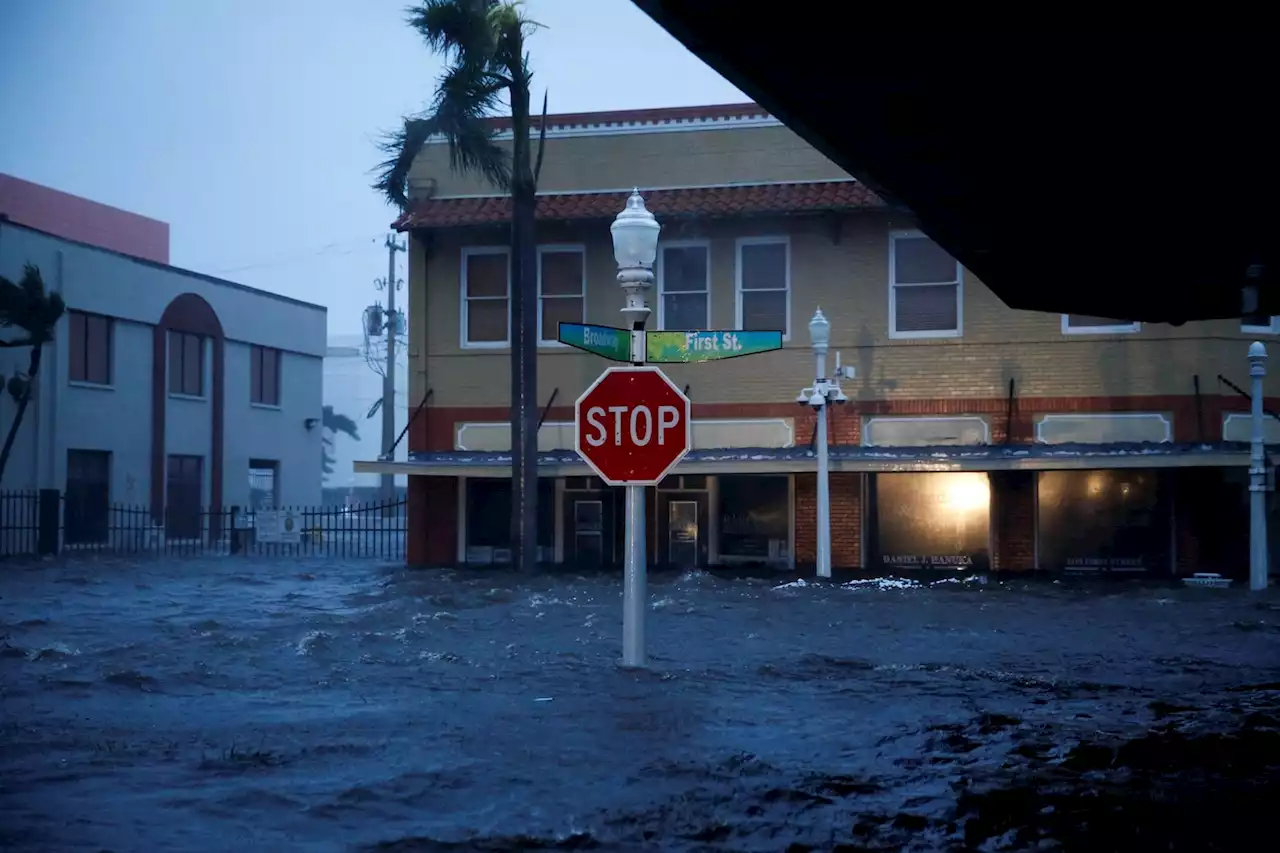
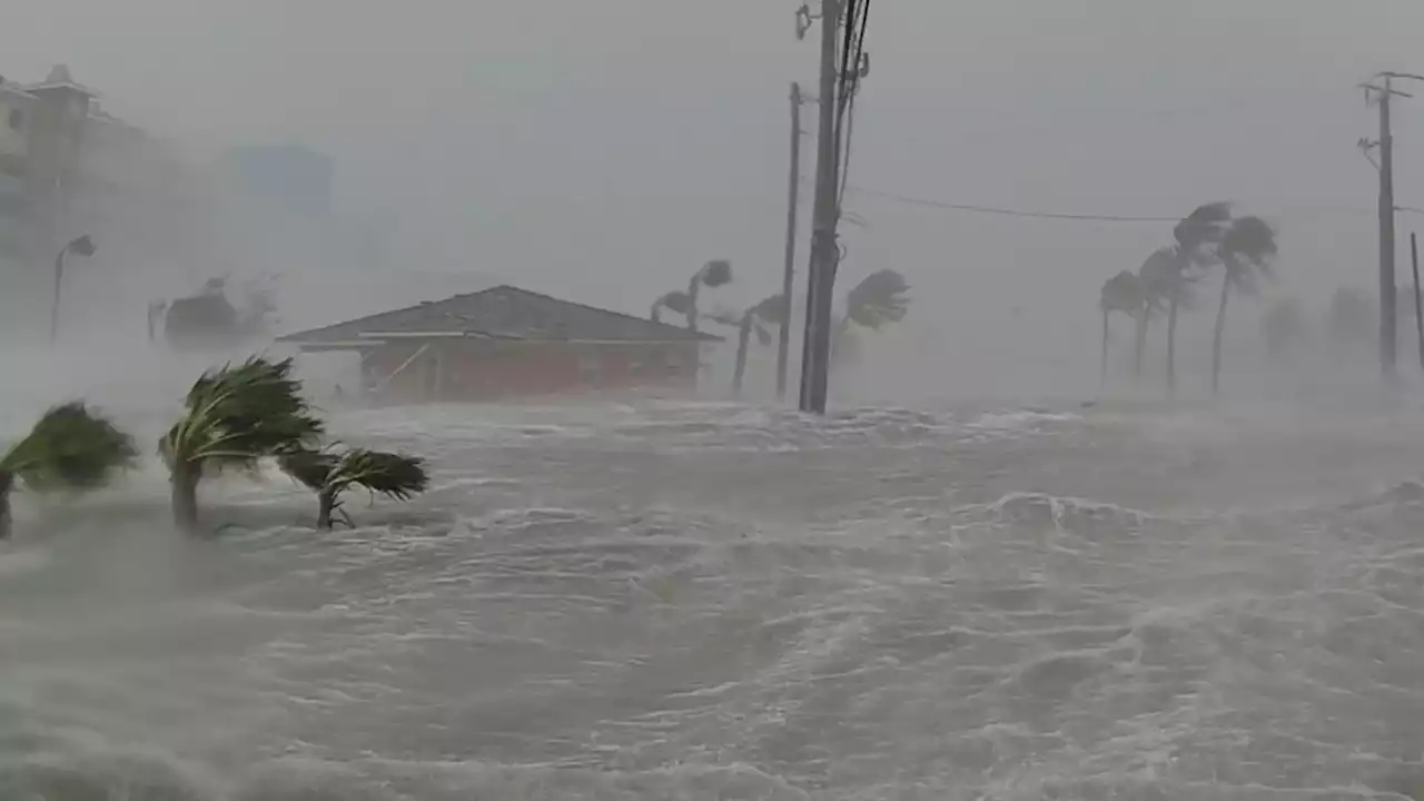
 Hurricane Ian live updates: Millions without power as Ian downgraded to tropical stormMore than two million people across Florida were without power, while some were trapped in flooded homes on Thursday after Hurricane Ian walloped the state.
続きを読む »
 Hurricane Ian live updates: Ian downgraded to tropical storm; over 2.5M lose power in FloridaIan weakens to tropical storm as 2.5M lose power in Florida. Virginia, Georgia, Carolinas under states of emergency. Follow coverage.
続きを読む »
 Hurricane Ian: Manatees at Spring Park fighting Hurricane Ian storm surge* LOCATIONS AFFECTED\n- Bonaire\n- Centerville\n- Clinchfield\n- Elberta\n- Elko\n- Grovania\n- Grove Park\n\n* WIND\n- LATEST LOCAL FORECAST: Below tropical storm force wind\n- Peak Wind Forecast: 15-25 mph with gusts to 45 mph\n\n- THREAT TO LIFE AND PROPERTY THAT INCLUDES TYPICAL FORECAST\nUNCERTAINTY IN TRACK, SIZE AND INTENSITY: Potential for wind 39\nto 57 mph\n- The wind threat has remained nearly steady from the\nprevious assessment.\n- PLAN: Plan for hazardous wind of equivalent tropical storm\nforce.\n- PREPARE: Remaining efforts to protect property should be\ncompleted as soon as possible. Prepare for limited wind\ndamage.\n- ACT: Move to safe shelter before the wind becomes hazardous.\n\n- POTENTIAL IMPACTS: Limited\n- Damage to porches, awnings, carports, sheds, and unanchored\nmobile homes. Unsecured lightweight objects blown about.\n- Many large tree limbs broken off. A few trees snapped or\nuprooted, but with greater numbers in places where trees\nare shallow rooted. Some fences and roadway signs blown\nover.\n- A few roads impassable from debris, particularly within\nurban or heavily wooded places. Hazardous driving\nconditions on bridges and other elevated roadways.\n- Scattered power and communications outages.\n\n* STORM SURGE\n- LATEST LOCAL FORECAST: Life-threatening storm surge possible\n- Peak Storm Surge Inundation: The potential for 4-6 feet\nabove ground somewhere within surge prone areas\n- Window of concern: through Friday evening\n\n- THREAT TO LIFE AND PROPERTY THAT INCLUDES TYPICAL FORECAST\nUNCERTAINTY IN TRACK, SIZE AND INTENSITY: Potential for storm\nsurge flooding greater than 3 feet above ground\n- The storm surge threat has remained nearly steady from the\nprevious assessment.\n- PLAN: Shelter against life-threatening storm surge of\ngreater than 3 feet above ground.\n- PREPARE: Flood preparations and ordered evacuations should\nbe complete. Evacuees should be in shelters well away from\nstorm surge flooding.\n- ACT: Remain shel
続きを読む »
 Hurricane Ian live updates: Hundreds of rescues in Florida as Ian eyes CarolinasLATEST: City of Sanibel officials said Thursday evening they have confirmed at least two fatalities. This brings the overall death toll from Ian to at least 11 that have been confirmed so far.
続きを読む »
 Hurricane Ian live updates: Ian makes landfall in South Carolina two days after first hitting FloridaIan made its second landfall near Georgetown, S.C. as a Category 1 hurricane on Friday afternoon.
続きを読む »